

Introduction-
Table of Contents
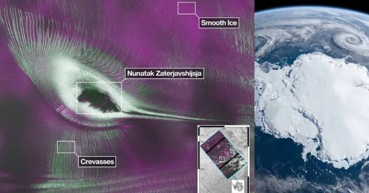
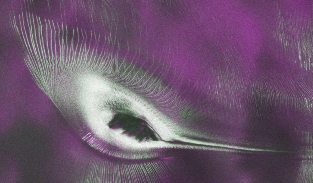
A unique radar image from the icy world of Antarctica has captured the attention of scientists and space enthusiasts worldwide. Radar data collected by the joint NASA-ISRO mission, NISAR (NASA-ISRO Synthetic Aperture Radar), revealed a shape resembling a hummingbird around the mountain peak of Nunatak Zaterjavshijsja in East Antarctica. However, this is not an image of an actual bird. This shape is composed of a combination of ice, mountains, glaciers, and natural landforms, which scientists have presented as a false-colour radar image.
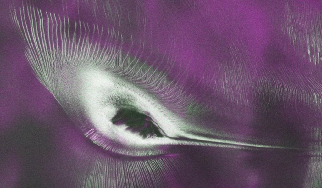
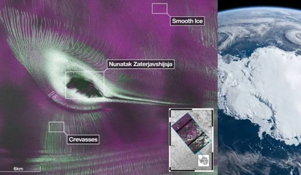
The dark colour in this radar image represents the exposed peak of the mountain (nunatak), the northeast-flowing ice stream resembles the bird’s tail, while the green lines represent deep crevasses in the glacier. This view was made possible not by a normal camera, but by L-Band Synthetic Aperture Radar (SAR) technology, which is capable of detailed study of the ice surface and its structure.
This discovery is not just a fascinating image, but is also important for understanding climate change, glacier movement, ice structure, and possible future sea-level changes. In this article, you will learn what the NISAR satellite is, how this “hummingbird” was formed, what the colours seen in radar images mean, what a nunatak is, and why this discovery is considered so important to scientists.
Our Other Useful Websites-
If you’re looking for information on educational topics, be sure to check out our website, edublog.cloud. Additionally, for digital products, be sure to check out our other website, vijaybooks.store.
Information on Chandra Shekhar Azad Jayanti 2026 and Lokmanya Bal Gangadhar Tilak Jayanti 2026 is also available on this website.
What is NASA’s NISAR Satellite?
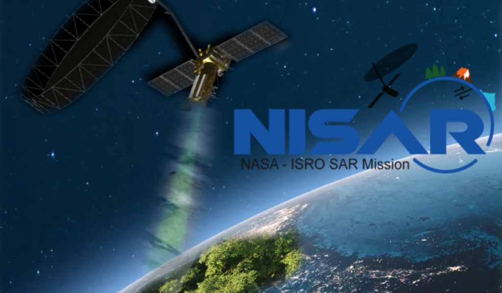
NISAR (NASA-ISRO Synthetic Aperture Radar) is the world’s first Earth observation satellite mission, jointly developed by the US space agency NASA and the Indian Space Research Organization (ISRO). The mission’s objective is to accurately study even the smallest changes in the Earth’s surface using cutting-edge radar technology. NISAR utilizes L-Band and S-Band Synthetic Aperture Radar (SAR), allowing it to collect high-quality data both day and night, even through clouds.
The satellite’s primary objective is to continuously monitor Earth’s changing environment and provide reliable information to scientists. NISAR will survey the Earth’s surface at regular intervals, making it easier to analyze natural changes over time. It will enable scientists to study land movement, glacier movement, changes in sea ice, forest conditions, and changes in agricultural areas.
NISAR will also play a key role in understanding the impacts of climate change. It will monitor the rate of glacier melt, changes in ice sheets, and signals related to sea-level rise. Furthermore, the mission will be useful in rapidly assessing areas affected by earthquakes, landslides, volcanic activity, floods, and other natural disasters. Data obtained from NISAR will provide a crucial foundation for scientific research, environmental protection, and disaster management.
How Did the ‘Hummingbird’ Appear in Antarctica?
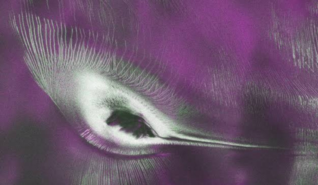
The ‘hummingbird’ in Antarctica is not actually a photograph of a bird, but a false-colour radar image created from radar data recorded by NASA-ISRO’s NISAR satellite. This view is of the area around Nunatak Zaterjavshijsja, a mountain peak located in East Antarctica. A nunatak is a mountain or rocky peak that appears above a thick layer of surrounding ice.
In this radar image, the mountain’s exposed peak appears dark, resembling the body of a hummingbird. An ice stream flowing northeast of the mountain creates the appearance of a bird’s long tail, while deep crevasses in the surrounding glacier appear like wings. The combination of all these natural elements, combined at a specific angle and the colour of the radar data, has created the hummingbird.
This landform is the result of natural processes occurring over millions of years. The continuously flowing glaciers, the cracks in the ice formed by mountain impacts, and the direction of ice flow have given this region its unique shape. NISAR’s L-Band Synthetic Aperture Radar (SAR) clearly recorded these surface and subsurface structures, which the scientists later presented using False Colour technology.
According to the scientists, this image is not only visually stunning but also extremely important for studying glacier movement, ice structure, mountain topography, and the effects of climate change. Such radar images will play a vital role in monitoring changes in Antarctica’s ice in the future and better understanding Earth’s changing environment.
Scientific Meaning of Each Part of the Image-
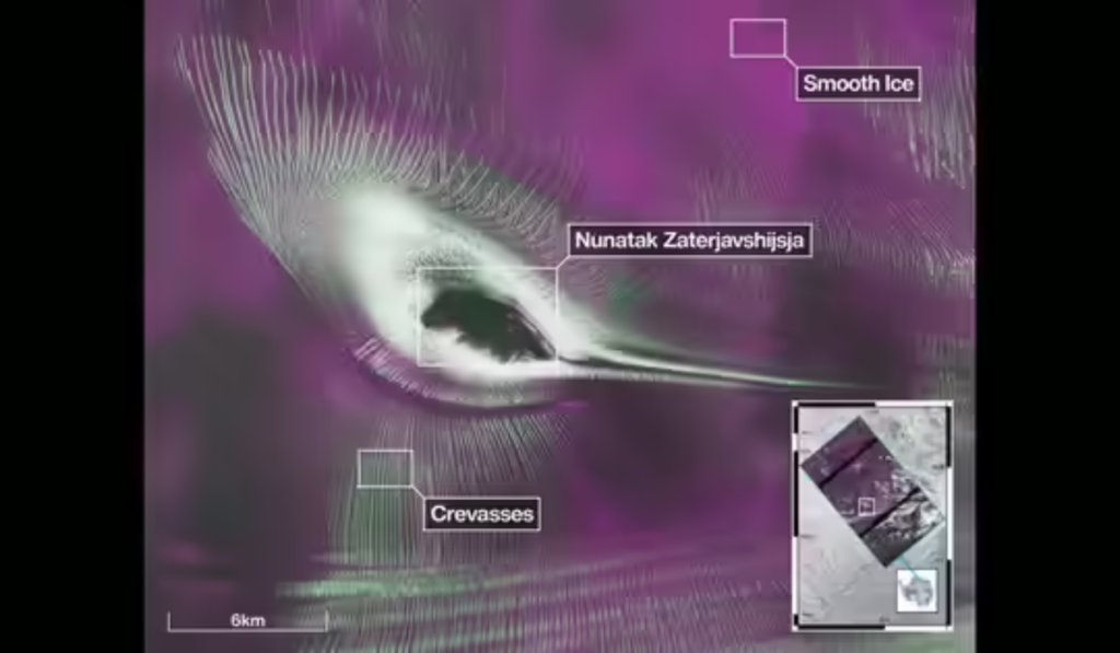
Each part of the image in this false-colour radar image, created from radar data recorded by the NISAR satellite, depicts a natural landform or ice structure. This image is not only visually appealing but also helps scientists understand the movements of Antarctica’s ice sheet and glaciers.
Dark Black Area: Mountaintop-
The dark or black area visible in the center of the image is the rocky mountain peak of Nunatak Zaterjavshijsja. This is the part that protrudes above the thick ice layer. Because there is no snow here, the reflection of the radar signal appears different from the surrounding ice. This part appears to resemble the body or belly of a hummingbird.
Tail: Northeast-Flowing Ice Stream-
The long ice stream extending northeasternly from the mountain resembles a hummingbird’s tail. This is actually an ice stream, in which ice slowly flows toward the sea. The direction and elongated shape of this flow give the image a bird-like appearance.
Wings: Deep Crevasses in the Glacier-
The green, fine, and sharp lines visible in the image are crevasses in the glacier. These crevasses form when flowing ice collides with the rugged surface of the mountain and is subjected to stress. These crevasses appear like wings spread in radar data and form the most striking part of the hummingbird.
Surrounding Ice: Distinction between Stable and Moving Ice-
The ice visible around the mountain is not completely uniform. Some areas are relatively stable ice, where the flow of ice is very slow, while others are dynamic ice that continues to move. NISAR’s radar data shows the distinct texture and surface of these two types of ice, allowing scientists to accurately study the ice’s movement, structure, and changes over time.
What did Radar Technology See that Ordinary Cameras Can’t?
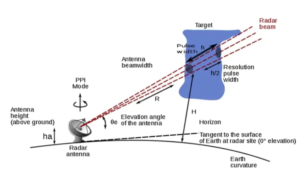
The NISAR satellite’s most significant feature is its L-Band Synthetic Aperture Radar (SAR) technology. It doesn’t rely on sunlight like ordinary cameras, but instead uses microwave signals to study the Earth’s surface. This allows NISAR to collect accurate data both day and night, even through clouds, fog, and light rain.
L-Band radar uses microwave signals with a wavelength of approximately 24 centimeters (approximately 1.2 GHz). The satellite sends these signals toward the Earth’s surface and records the backscatter. Different surfaces-such as ice, rock, vegetation, or water-reflect these signals differently. By analyzing this difference, scientists determine the surface’s texture and condition.
The greatest advantage of L-Band Radar in regions like Antarctica is that it can penetrate to limited depths beneath dry ice and snow, providing useful information about its internal structure and features beneath the surface. Although it cannot see deep into solid rock, it is extremely effective in studying the structure of ice layers, cracks, and glaciers.
In contrast, optical cameras only record visible light reflected from the surface. Their capabilities are limited if it is cloudy, dark, or the surface is completely covered with snow. Radar technology, on the other hand, is virtually unaffected by weather and lighting conditions.
This technology allows scientists to accurately analyze glacier movement, changes in ice thickness, surface deformation, landslides, landform changes after earthquakes, and the effects of climate change over long periods of time. This is why NISAR’s radar is considered a vital scientific tool for Earth monitoring and environmental research.
What Do the Colours in the Image Mean?
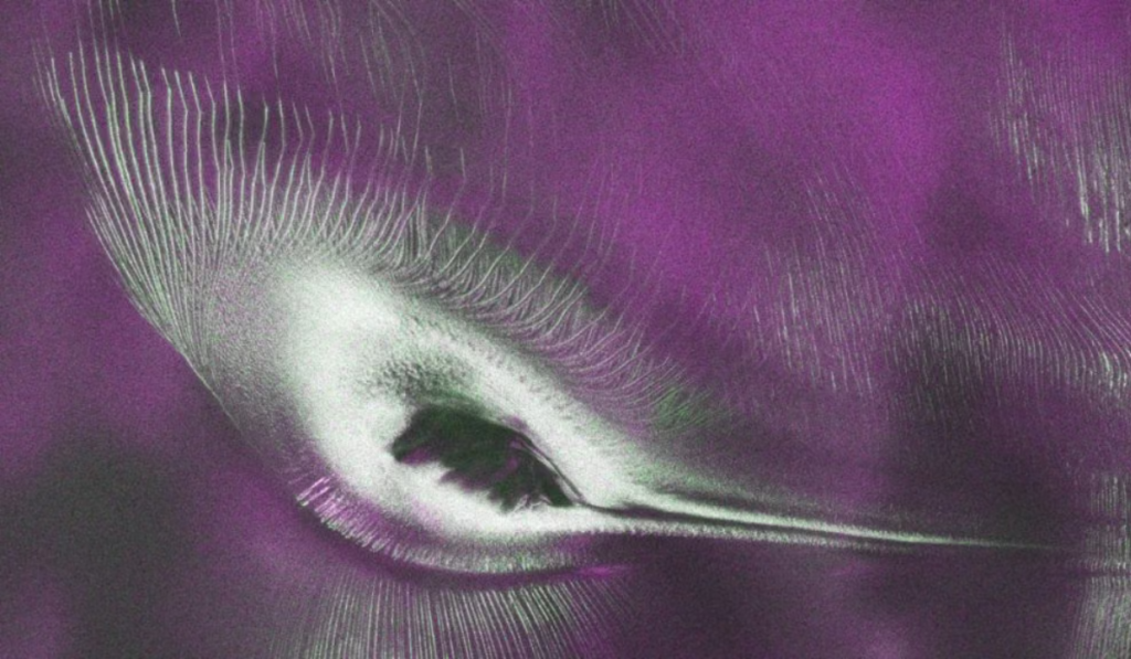
This image of Antarctica, released by the NISAR satellite, is not a photo taken with a standard camera, but a false-colour radar image. This means that the colours displayed in it are not natural. Scientists convert microwave data obtained from radar into different colours to easily identify and analyze various features of the ice, rocks, and surface.
The green colour in this image indicates areas where the ice surface is uneven and broken. These green lines are actually deep crevasses in the glacier. When NISAR’s radar sends vertically polarized microwave signals, such rough and cracked surfaces scatter the signals in many directions. This is why these areas appear green.
The magenta (pink-purple) colour represents relatively flat and regular ice. In such areas, radar signals are reflected in a more systematic manner, which is associated with horizontal polarization. This helps scientists understand which areas are stable and where the ice surface is more uniform.
The purpose of a false colour image is not to show the actual colour of a location, but to present radar data in a way that clearly shows the differences between different surface structures and their physical characteristics. This is why images appear green, magenta, or other colours, while in reality, most of Antarctica is covered in white ice.
Such images are extremely important for scientists because they allow them to more accurately analyze glacier cracks, ice flow direction, surface roughness, and changes over time. This also makes it easier to monitor climate change and changes in ice cover.
What is a Nunatak?
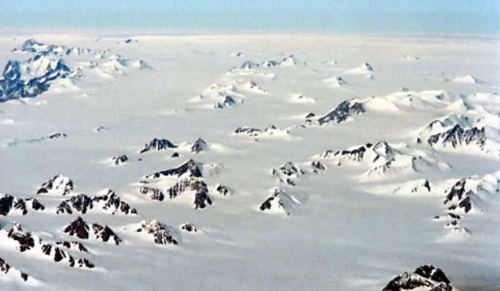
A nunatak is a rocky mountain peak or hill that remains visible above the surface despite being completely surrounded by a glacier or a large ice sheet. Simply put, when a thick layer of ice covers an area, but the top of a high mountain is not covered by snow, that protruding portion is called a nunatak.
Nunataks form over millions of years. When a glacier or ice sheet covers a mountainous region, only the highest rocky peaks are visible above the ice. Over time, ice flow and erosion alter the surrounding surface, but these high peaks remain exposed and form nunataks.
Nunataks are primarily found in Antarctica, Greenland, the Arctic region, Alaska, Canada, Iceland, and high-mountain glaciers, where a thick layer of ice remains present year-round.
Nunataks in Antarctica are of particular importance because they help scientists understand ice thickness, glacier movement, and the region’s geological structure. Nunatak Zaterjavshijsja is one such peak, whose radar image appeared as a hummingbird in the NISAR satellite. It is also considered an important natural indicator for studying climate change and long-term changes in ice cover.
Why is this Discovery Important to Scientists?
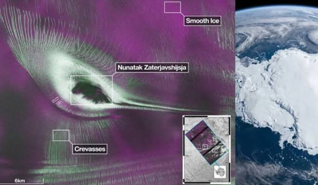
This radar image recorded in Antarctica by the NISAR satellite not only reveals a fascinating natural feature but also provides scientists with crucial data to understand changes occurring in Earth’s polar regions. Such high-resolution radar imaging allows long-term monitoring of subtle changes in glaciers, ice sheets, and snow surfaces.
The most important use is in measuring glacier flow. By taking images of the same area at regular intervals, NISAR can determine how fast the ice is moving or how its speed has changed over time. This allows scientists to more accurately assess the stability and future of glaciers.
This mission will also play a vital role in monitoring ice melt and changes in ice sheets. If ice in an area is rapidly decreasing or its structure is changing, radar data helps detect these changes in time.
This information is also directly related to the study of potential sea level rise. The melting of the Antarctic and Greenland ice sheets affects global sea level. Data obtained from NISAR will help scientists develop more accurate models of future sea level rise.
In addition, this mission is also crucial for understanding the effects of climate change. Changes in ice thickness, glacier movement, and snow cover are important indicators of Earth’s changing climate system. NISAR’s long-term data will provide a reliable basis for future scientific research, climate modeling, environmental protection, and disaster risk assessment.
Key Features of the NISAR Satellite-
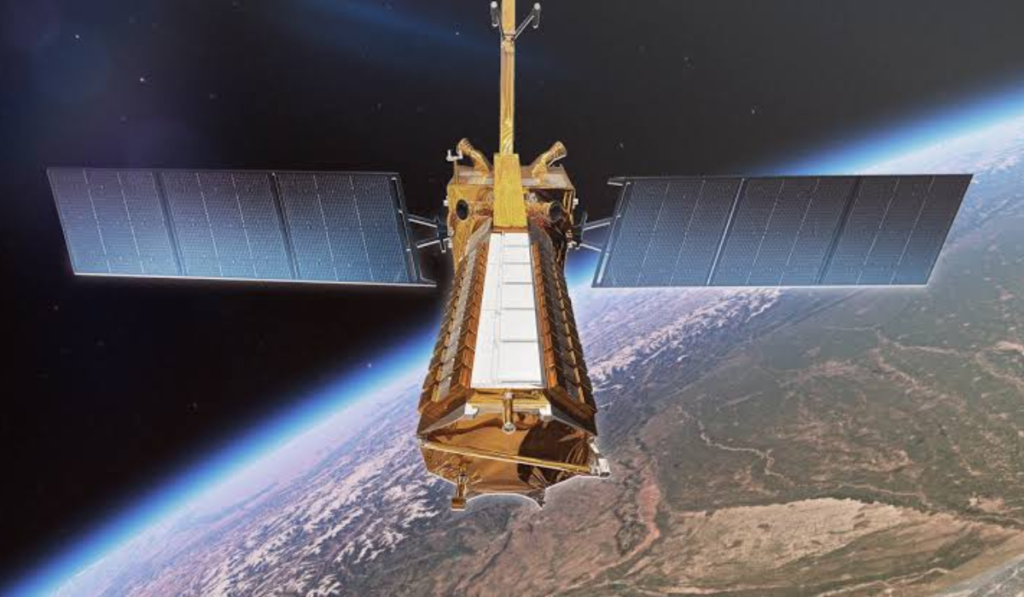
NISAR (NASA-ISRO Synthetic Aperture Radar) is one of the most advanced radar satellite missions developed to monitor the Earth’s environment and landforms. Its advanced technology distinguishes it from traditional Earth observation satellites. Its key features include:
- L-Band Radar: It uses long-wavelength microwave signals, allowing detailed study of the structure of dense forests, ice sheets, and dry ice layers.
- S-Band Radar: The S-Band radar developed by ISRO helps record subtle changes in the Earth’s surface. The combined use of L-Band and S-Band provides more accurate and comprehensive data.
- Ability to operate day and night: NISAR is not dependent on sunlight, so it can monitor the Earth 24 hours a day.
- Cloud-penetrating capability: Microwave radar technology enables it to collect high-quality data even through clouds, haze, and light rainfall.
- High-resolution imaging: It can detect even tiny changes in the Earth’s surface, allowing scientists to conduct more accurate analyses.
- Global coverage: NISAR will survey the entire Earth at regular intervals, making it easier to compare environmental changes in different regions.
- Regular data collection: It will conduct repeated radar imaging of the same location at set times, allowing continuous monitoring of glacier movement, forest changes, land subsidence, and the effects of natural disasters. These features make NISAR a vital mission for Earth science and climate research.
Why is this Discovery Important to the Public?
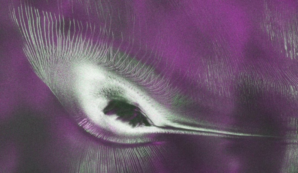
This radar image recorded by the NISAR satellite in Antarctica is not just a scientific achievement, but also has significance for the lives of ordinary people. Changes in the Earth’s polar regions impact the world’s weather, environment, and sea level. Therefore, accurate information about these changes is crucial for every country and society.
First, this mission helps to better understand climate change. By studying glacier melt, changes in ice sheets, and ice flow, scientists can more accurately predict future environmental impacts.
This technology is also useful in preparing for future natural disasters. Data obtained from NISAR helps rapidly assess affected areas after events such as earthquakes, landslides, floods, volcanic activity, and landslides. This helps governments and disaster management agencies make timely decisions.
This mission is also an excellent example of the advancement of scientific technology. Advanced radar technology has now made Earth observation more accurate and continuous than ever before, allowing for better analysis of environmental changes.
In addition, information obtained from NISAR plays a vital role in better Earth monitoring. Changes in forests, glaciers, agricultural land, and coastal areas can be regularly monitored.
This mission is also extremely useful for education and scientific research. The availability of reliable data to universities, research institutes, and environmental experts will foster new research in Earth science, climate studies, and geography. This will also enable future generations to better understand Earth’s changing environment.
Interesting Facts About This Image-
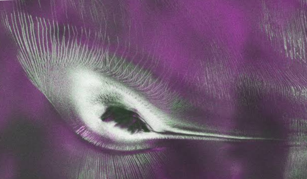
This famous photo of Antarctica appears to resemble a hummingbird at first glance, but it’s not actually a photo of a bird. The shape is formed by the natural formation of ice, rocks, and glaciers in the Nunatak Zaterjavshijsja region of East Antarctica. Its most striking feature is that this shape is only clearly visible from above, making it easily recognizable in radar data obtained from space.
This image was not taken with a conventional camera, but is a false-colour radar image created from Synthetic Aperture Radar (SAR) data collected by NASA-ISRO’s NISAR satellite. The colours displayed in it are not real but have been rendered to facilitate scientific analysis.
In this scene, the exposed mountain peak, flowing ice stream, and deep crevasses in the glaciers combine to create the hummingbird. This natural formation makes this image one of the most interesting radar images in the world.
For scientists, this is not only a fascinating sight but also important scientific evidence for studying the movement of glaciers, the structure of ice, changes in ice sheets, and the effects of climate change.
Frequently Asked Questions (FAQs) about NASA’s NISAR Satellite spots ‘Hummingbird’ in Antarctica-
What is NASA’s NISAR satellite?
NISAR (NASA-ISRO Synthetic Aperture Radar) is a joint Earth observation mission between NASA and ISRO. It uses state-of-the-art L-Band and S-Band radar technology to collect high-resolution data of the Earth’s surface, glaciers, forests, ice sheets, and areas affected by natural disasters.
How did the hummingbird form in Antarctica?
This is not a photograph of an actual bird. Mountains, flowing ice streams, and deep crevasses in glaciers in the Nunatak Zaterjavshijsja region of East Antarctica combined to create a shape in radar data that resembles a hummingbird when viewed from above.
What is a nunatak?
A nunatak is a rocky mountain peak that appears above the surrounding thick ice or snow sheet. Despite being surrounded by glaciers, it is not completely covered by ice and helps scientists understand the geological structure of the region.
Why is L-Band Radar special?
L-Band Radar uses long-wavelength microwave signals. It can operate day and night, even through clouds, and is capable of accurately studying subtle changes in the structure of ice sheets, forests, and land.
What is a False Colour Image?
A False Colour Image is a scientific image in which data obtained from radar or other sensors is displayed in different colours instead of the actual colours. This allows for clearer distinctions between ice, rocks, cracks, and various surface structures.
How does this discovery relate to climate change?
Radar data collected by NISAR helps scientists monitor the movement of glaciers, changes in ice sheets, and ice melt. This information can be used to more accurately assess the impacts of climate change, potential sea-level rise, and future environmental changes.
Conclusion-
The “hummingbird” radar image recorded in Antarctica by the joint NASA-ISRO NISAR (NASA-ISRO Synthetic Aperture Radar) mission is a significant achievement in modern space science. It is not a photograph of an actual bird, but a natural landform formed by the Nunatak Zaterjavshijsja Mountains, a flowing ice stream, and glacial crevasses, presented as a false-colour radar image. This discovery once again proves that advanced radar technology can provide vital information about even the Earth’s most inaccessible regions.
The NISAR satellite will prove to be a vital scientific tool for Earth and climate studies. Its L-band and S-band radar technology is capable of continuously monitoring glacier movement, ice melt, subtle changes in land surface, and the effects of climate change. This will enable scientists to more accurately analyze potential sea-level rise, environmental changes, and the risks associated with natural disasters. In the future, such missions will provide new insights into Earth science, environmental protection, and disaster management.
This unique radar image of Antarctica is not only a fascinating sight but also an example of the wonderful union of science and nature. It shows us that modern space technology is not only opening the way to new discoveries but also playing a vital role in protecting and better understanding Earth. In the years to come, data from missions like NISAR will prove extremely useful for scientific research, education, and global environmental protection.